The Road to Trollville
Cycling "through" The Hunuas
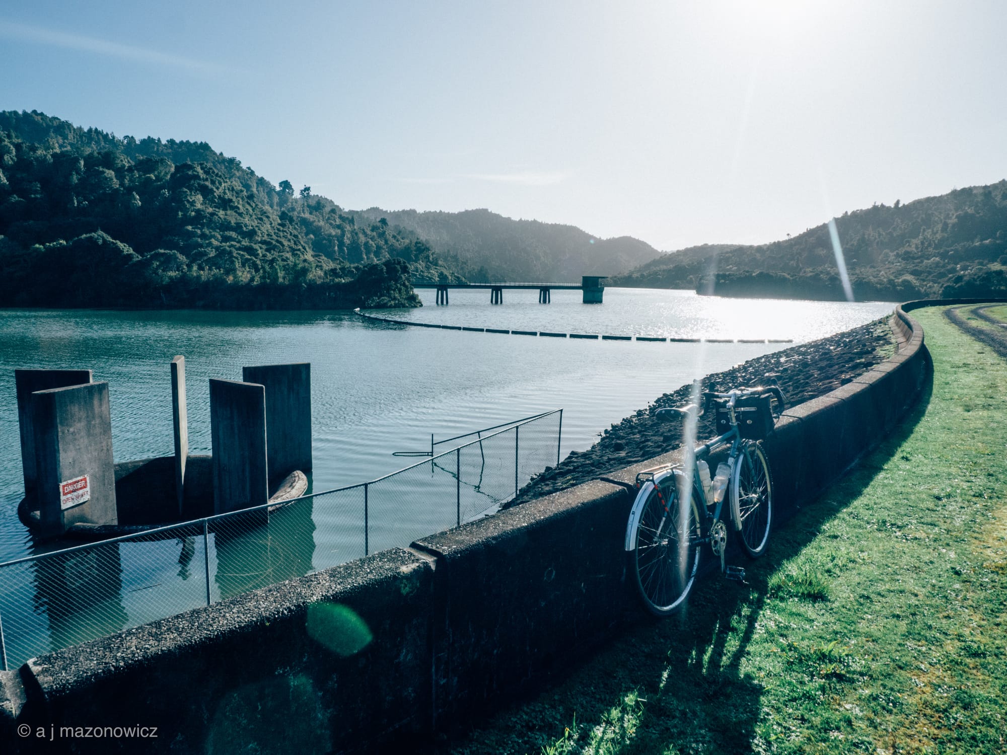
I was at Tumeke Cycle Space the other day (either selflessly helping someone or standing uselessly around) when I mentioned something about “cycling through the Hunuas”. Guy pointed out that I hadn’t really cycled through the Hunuas – I had cycled around them. Ok, I thought, fine I thought, I’ll show you who can ride through them. So on a rainy Saturday morning, I packed a couple of peanut butter & cheese sandwiches in to my bag, filled 3 waterbottles and got on the train. I disembarked in Papakura and rode off up the hill to Hunua, and then down towards the dams. I hung a left in to Moumoukai Rd and visited the Wairoa Dam.

After basking in the morning sunshine for a bit, I followed the gravel road to the scenic Upper Mangatawhiri Reservoir.

At the western end of the dam, I rode along the unexpectedly beautiful Waterline Rd.

As I puffed my way to the top of the hill, it started to rain. So I had a little break. I ate a sandwich, put my jacket on and then remounted my bike & turned right on to Keeney Rd, which was a much less pleasant grade of gravel.

If the rocks are the size of cricket balls, is it still gravel? I’m not sure if bicycles are really welcome on that road – I saw some signs with bikes on, some signs with bikes with lines through them. Also the native bush had turned in to pine plantation, so I suspect that some logging goes on here sometimes.

Eventually the road improved and I emerged from the forest in the artisanal Ness Valley. I could tell it was the Ness Valley because I saw some artisanal water buffalo. I also rode through a monkey’s wedding, and set a record for slowest ever Strava ride through the area (hurrah!).
Cycling from there to Papakura seemed like hard work, maybe there was a headwind, maybe I was just tired. But when I actually got to Papakura it felt too early to get on the train, so I thought I’d ride home. I’m not very familiar with that part of Auckland so I took the simplest route north – the Great South Rd. Which started off ok with some cycle lanes, but they disappeared around Te Mahia, and the local car drivers started to get a little too aggressive. So I ducked off to the Te Mahia railway station, which I think might be the horriblest railway station in Auckland.

After about 20 minutes a train arrived and took me safely north to Puhuniu, where I got off to go looking for a shortcut between McLaughlins Rd and Prices Rd. I had tried to find this before, searching from Puhunui Reserve, but without success. After circling the area for some time, going in all sorts of wrong directions, I finally found the entrance to a reserve off Aerovista Place.

My joy at finding it was somewhat tempered by the fact that it’s not a very nice reserve. There was a bundle of clothes in the bushes that I at first assumed was a dead body, then there was a scary bridge (that could easily have trolls living under) leading to a dead end.

I eventually got on the right path, that turned out to be signposted as part of the Te Araroa Trail(!). But after a few minutes the trail ended and the place where the shortcut should have been, turned out to be a big muddy field with sheep in that I had to push my bike across. At the other side of the field, I lifted my bike over a fence, climbed over myself and found a sign telling me I had just crossed some private property. So I give up, there’s no shortcut.

Prices Road was nice enough though, with it’s alpacas, horses and aeroplanes. And then I just had to ride the back way through the airport, and through Mangere & Onehunga back to town.

So I think that a) there’s definitely more exploring to be done in the Hunuas, and b) I really need to find a better route from Papakura in to town.
Route here.